
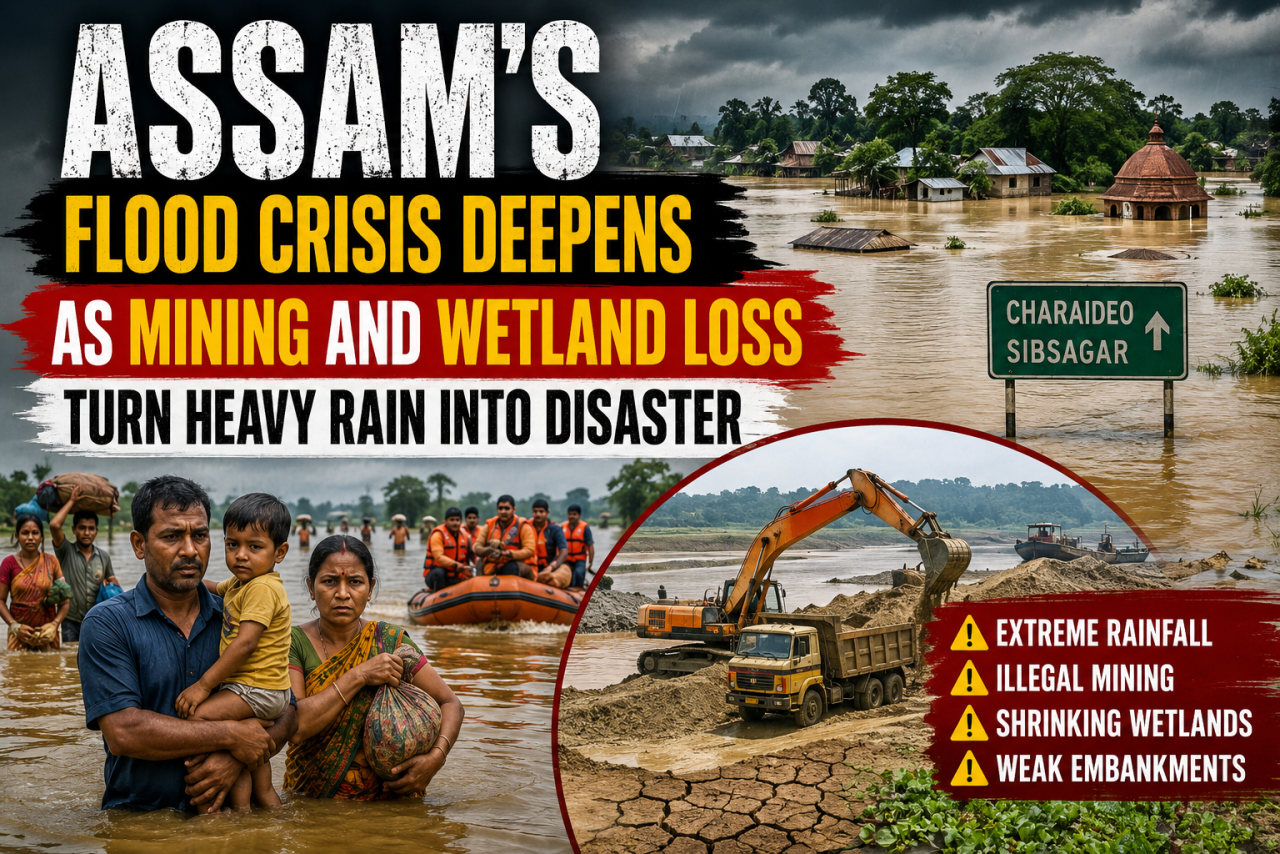
Assam's latest floods were not caused by rain alone. Years of ecological damage, unchecked mining, and disappearing wetlands have turned extreme weather into a recurring humanitarian crisis.
Assam is once again battling devastating floods, but this year's crisis has highlighted a deeper and more worrying reality. Years of unchecked sand and stone mining, weakening embankments, and the steady disappearance of wetlands have significantly reduced the state's ability to absorb heavy rainfall, turning intense monsoon spells into large-scale disasters.
Extreme Rainfall Triggers Widespread Flooding
The immediate cause of the latest flooding was an intense spell of rainfall between July 18 and July 20, which affected several districts simultaneously.
Charaideo recorded an extraordinary 493 percent above-normal rainfall during the three-day period, while neighbouring Sibsagar received 104 percent more rainfall than usual. Across Assam, rainfall during these days stood 181 percent above normal.
The situation was equally severe in neighbouring hill states. Mokokchung district in Nagaland also recorded 493 percent excess rainfall, while Wokha and Mon districts experienced unusually heavy precipitation, sending large volumes of water downstream into Assam's floodplains.
Experts Warn of Long-Term Ecological Damage
Researchers say the floods are not solely the result of extreme rainfall. They argue that years of environmental degradation have amplified the disaster.
Mirza Zulfiqar Rahman, who studies the Brahmaputra basin, said the crisis reflects a wider pattern across Assam and the Northeast. According to him, weakened embankments can no longer withstand sudden surges, while excessive sand and stone mining has altered riverbeds and disrupted natural drainage systems.
He also highlighted the rapid loss of wetlands, which traditionally act as natural sponges by storing excess water during heavy rainfall and reducing the risk of flooding in nearby settlements.
Families Face Unprecedented Floodwaters
The human impact has been severe.
Rupak Gogoi, a 38-year-old government schoolteacher from Charaideo district, recalled how floodwaters entered his family home without warning on the night of July 18. His elderly parents and younger brother were trapped as water rose to nearly five feet, completely submerging the ground floor.
The family said they had never witnessed flooding of such intensity before. While they remembered the floods of 2018, they described this year's disaster as significantly more destructive.
Floodwaters Reach Previously Safe Areas
Officials have confirmed that both Charaideo and Sibsagar experienced unprecedented flooding this year.
In Charaideo, 35 administrative divisions were affected. Meanwhile, floodwaters spread into several parts of Sibsagar that had previously remained untouched by major floods.
Residents said the unusually intense rainfall, concentrated within a short period rather than spread across the monsoon season, overwhelmed rivers, drainage systems, and flood-control infrastructure.
Environmental Concerns Return to the Spotlight
The disaster has reignited debate over Assam's land-use policies and environmental management.
Local leaders and forest officials have raised concerns over large-scale infrastructure projects, including highway construction, that have encroached upon wetlands and forest areas along the Brahmaputra and its tributaries.
Experts have called for:
- Restoration and protection of wetlands
- Large-scale afforestation
- Stronger regulation of sand and stone mining
- A comprehensive review of embankment safety
- Sustainable floodplain management policies
Search Operation Ends Safely
The floods also disrupted government operations.
A search operation was launched after 26 forest department personnel and three villagers went missing during a routine patrol near the Dikhow River along the Assam-Nagaland border.
The team had been conducting a joint patrol with Nagaland forest officials on July 23 and lost contact for nearly two days before all members were traced safely on July 26.
Call for Regional Cooperation
The crisis has also strengthened calls for closer coordination between Assam and neighbouring states.
Environmental experts argue that river basins and hill catchments are interconnected. Heavy rainfall in Nagaland and other upstream regions often flows into Assam's plains, making interstate cooperation on watershed management, flood forecasting, and climate adaptation increasingly essential.
Structural Reforms Needed
While floodwaters have begun to recede in several areas, experts caution that the underlying causes remain unresolved.
Shrinking wetlands, continued mining activity, fragile embankments, and expanding infrastructure in ecologically sensitive areas have made Assam increasingly vulnerable to extreme weather events.
Unless long-term structural reforms are undertaken to protect rivers, wetlands, forests, and floodplains, researchers warn that similar or even more severe flooding could become a recurring feature of future monsoon seasons.
Assam is once again battling devastating floods, but this year's crisis has highlighted a deeper and more worrying reality. Years of unchecked sand and stone mining, weakening embankments, and the steady disappearance of wetlands have significantly reduced the state's ability to absorb heavy rainfall, turning intense monsoon spells into large-scale disasters.
Extreme Rainfall Triggers Widespread Flooding
The immediate cause of the latest flooding was an intense spell of rainfall between July 18 and July 20, which affected several districts simultaneously.
Charaideo recorded an extraordinary 493 percent above-normal rainfall during the three-day period, while neighbouring Sibsagar received 104 percent more rainfall than usual. Across Assam, rainfall during these days stood 181 percent above normal.
The situation was equally severe in neighbouring hill states. Mokokchung district in Nagaland also recorded 493 percent excess rainfall, while Wokha and Mon districts experienced unusually heavy precipitation, sending large volumes of water downstream into Assam's floodplains.
Experts Warn of Long-Term Ecological Damage
Researchers say the floods are not solely the result of extreme rainfall. They argue that years of environmental degradation have amplified the disaster.
Mirza Zulfiqar Rahman, who studies the Brahmaputra basin, said the crisis reflects a wider pattern across Assam and the Northeast. According to him, weakened embankments can no longer withstand sudden surges, while excessive sand and stone mining has altered riverbeds and disrupted natural drainage systems.
He also highlighted the rapid loss of wetlands, which traditionally act as natural sponges by storing excess water during heavy rainfall and reducing the risk of flooding in nearby settlements.
Families Face Unprecedented Floodwaters
The human impact has been severe.
Rupak Gogoi, a 38-year-old government schoolteacher from Charaideo district, recalled how floodwaters entered his family home without warning on the night of July 18. His elderly parents and younger brother were trapped as water rose to nearly five feet, completely submerging the ground floor.
The family said they had never witnessed flooding of such intensity before. While they remembered the floods of 2018, they described this year's disaster as significantly more destructive.
Floodwaters Reach Previously Safe Areas
Officials have confirmed that both Charaideo and Sibsagar experienced unprecedented flooding this year.
In Charaideo, 35 administrative divisions were affected. Meanwhile, floodwaters spread into several parts of Sibsagar that had previously remained untouched by major floods.
Residents said the unusually intense rainfall, concentrated within a short period rather than spread across the monsoon season, overwhelmed rivers, drainage systems, and flood-control infrastructure.
Environmental Concerns Return to the Spotlight
The disaster has reignited debate over Assam's land-use policies and environmental management.
Local leaders and forest officials have raised concerns over large-scale infrastructure projects, including highway construction, that have encroached upon wetlands and forest areas along the Brahmaputra and its tributaries.
Experts have called for:
- Restoration and protection of wetlands
- Large-scale afforestation
- Stronger regulation of sand and stone mining
- A comprehensive review of embankment safety
- Sustainable floodplain management policies
Search Operation Ends Safely
The floods also disrupted government operations.
A search operation was launched after 26 forest department personnel and three villagers went missing during a routine patrol near the Dikhow River along the Assam-Nagaland border.
The team had been conducting a joint patrol with Nagaland forest officials on July 23 and lost contact for nearly two days before all members were traced safely on July 26.
Call for Regional Cooperation
The crisis has also strengthened calls for closer coordination between Assam and neighbouring states.
Environmental experts argue that river basins and hill catchments are interconnected. Heavy rainfall in Nagaland and other upstream regions often flows into Assam's plains, making interstate cooperation on watershed management, flood forecasting, and climate adaptation increasingly essential.
Structural Reforms Needed
While floodwaters have begun to recede in several areas, experts caution that the underlying causes remain unresolved.
Shrinking wetlands, continued mining activity, fragile embankments, and expanding infrastructure in ecologically sensitive areas have made Assam increasingly vulnerable to extreme weather events.
Unless long-term structural reforms are undertaken to protect rivers, wetlands, forests, and floodplains, researchers warn that similar or even more severe flooding could become a recurring feature of future monsoon seasons.






















Leave a Comment