
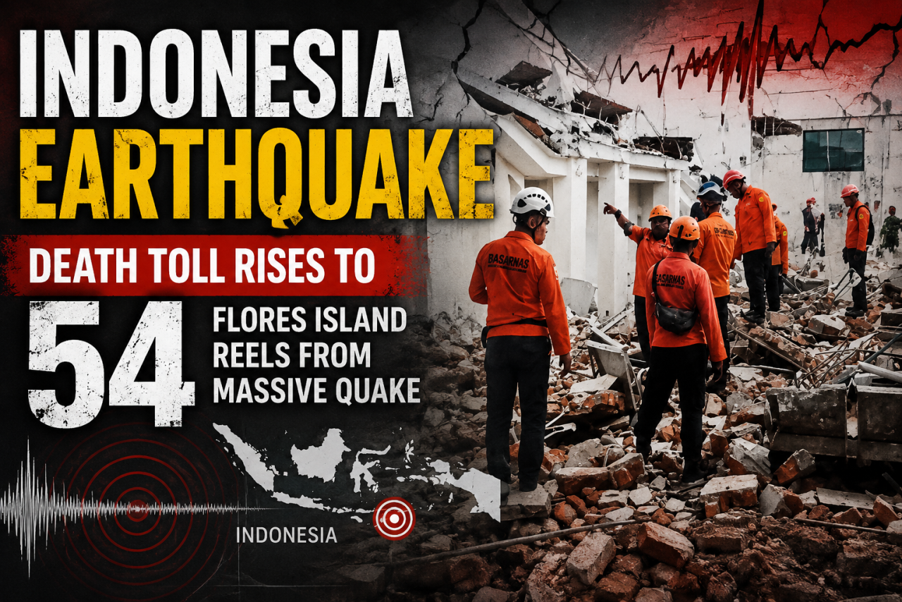
A deadly 7.7-magnitude earthquake has devastated Indonesia’s Flores Island, leaving dozens dead, thousands displaced and rescue teams racing against continuing aftershocks.
A powerful magnitude 7.7 earthquake struck off Indonesia’s Flores Island early on August 15, leaving a trail of death and destruction across East Nusa Tenggara province. Three days later, rescue teams are still recovering bodies from collapsed buildings and reaching communities isolated by landslides.
The death toll has risen to 54, while 135 people have been injured and more than 1,300 homes damaged, according to Indonesia’s National Disaster Management Agency (BNPB). Authorities have warned that the casualty figures could increase as search operations continue in areas that remain difficult to access.
What Happened
The earthquake struck at 5:58 am local time on August 15, with its epicentre about 68 kilometres north-northwest of Ende in East Nusa Tenggara. The United States Geological Survey recorded the earthquake at a depth of just 10 kilometres.
The shallow depth made the earthquake particularly destructive because much of its energy was released close to the surface, producing intense ground shaking across the region.
BNPB chief Suharyanto said the damage was concentrated across six regencies. Manggarai and East Manggarai were among the worst affected, followed by Sikka, West Manggarai, Ngada and Ende.
The main earthquake was followed by more than 340 aftershocks, with the strongest measuring magnitude 6.2. Another magnitude 5.9 tremor struck the region on Monday morning, renewing fears among residents and complicating rescue operations.
Minutes after the earthquake, Indonesia’s meteorology agency issued a tsunami warning and urged coastal residents to move to higher ground. Sea-level monitoring stations subsequently detected small tsunami waves at several locations, with the highest reaching nearly one metre near Maurole in Ende regency.
The warning was lifted within hours after authorities determined that there was no continuing threat of a major destructive tsunami.
The Human Cost
The scale of the disaster has become clearer as rescue workers reach affected communities.
In the port town of Maumere, rescue teams reported recovering bodies from beneath collapsed houses and shops. In Nagekeo regency, one of the areas closest to the epicentre, landslides blocked roads and disrupted telephone networks, delaying rescue operations.
With road access cut off, officials eventually sent a rescue team by ferry to reach isolated communities.
A university lecturer in Ruteng described being violently awakened by the earthquake. She said the shaking felt as though the ground was bouncing like a trampoline.
Inside her home, a television, her son’s trophies and suitcases stored on top of a wardrobe came crashing down as she rushed outside with her family. By the time she reached safety, neighbours were already in the streets, screaming in fear.
Around 5,000 people have been evacuated and are now staying in temporary shelters.
Preliminary government assessments indicate that 157 homes were heavily damaged, 41 moderately damaged and nearly 150 lightly damaged. Damage has also been reported at 87 schools, 18 health facilities, five places of worship and several government buildings.
The destruction has disrupted essential services and daily life across the province.
Why Flores Is So Vulnerable
Indonesia lies along the Pacific Ring of Fire, a vast horseshoe-shaped zone where several tectonic plates meet. The country is consequently among the world’s most earthquake- and volcano-prone regions.
Flores has experienced devastating earthquakes before.
In December 1992, a powerful earthquake struck the same broad stretch of coastline and triggered a tsunami that killed more than 2,500 people, according to Indonesia’s geophysics agency.
Officials have said the latest earthquake occurred in the Flores Back-Arc Thrust, the same general tectonic setting associated with the 1992 disaster.
The combination of active faults, shallow earthquakes, mountainous terrain and landslide-prone areas makes emergency response particularly difficult.
Rescue Efforts Continue
Indonesia has declared a 14-day emergency response period for the affected regencies, allowing authorities to mobilise additional personnel, resources and emergency funds.
Two helicopters and a rescue vessel have been deployed to reach communities cut off by debris and landslides. Rescue agencies are also working to restore access to affected roads and communications networks.
International assistance is beginning to support the response. European Commission President Ursula von der Leyen has offered satellite support through the European Union’s Copernicus Earth observation programme, which can help rescue teams assess damage and identify isolated areas.
Final Take
The immediate priority remains finding survivors and reaching communities that remain cut off.
With aftershocks continuing and another moderate earthquake striking on Monday, authorities have urged residents to remain alert and stay away from buildings showing visible cracks until they have been inspected.
For thousands of displaced residents, however, the crisis will not end when the rescue operation does.
Homes, schools, health facilities and public infrastructure will need to be rebuilt. Communities will also need sustained access to food, water, medical care and temporary accommodation.
For Flores, the earthquake is another reminder of the risks posed by living in one of the world’s most tectonically active regions. As rescue teams continue their search, the focus is gradually shifting from saving lives to helping survivors begin the difficult process of rebuilding.
A powerful magnitude 7.7 earthquake struck off Indonesia’s Flores Island early on August 15, leaving a trail of death and destruction across East Nusa Tenggara province. Three days later, rescue teams are still recovering bodies from collapsed buildings and reaching communities isolated by landslides.
The death toll has risen to 54, while 135 people have been injured and more than 1,300 homes damaged, according to Indonesia’s National Disaster Management Agency (BNPB). Authorities have warned that the casualty figures could increase as search operations continue in areas that remain difficult to access.
What Happened
The earthquake struck at 5:58 am local time on August 15, with its epicentre about 68 kilometres north-northwest of Ende in East Nusa Tenggara. The United States Geological Survey recorded the earthquake at a depth of just 10 kilometres.
The shallow depth made the earthquake particularly destructive because much of its energy was released close to the surface, producing intense ground shaking across the region.
BNPB chief Suharyanto said the damage was concentrated across six regencies. Manggarai and East Manggarai were among the worst affected, followed by Sikka, West Manggarai, Ngada and Ende.
The main earthquake was followed by more than 340 aftershocks, with the strongest measuring magnitude 6.2. Another magnitude 5.9 tremor struck the region on Monday morning, renewing fears among residents and complicating rescue operations.
Minutes after the earthquake, Indonesia’s meteorology agency issued a tsunami warning and urged coastal residents to move to higher ground. Sea-level monitoring stations subsequently detected small tsunami waves at several locations, with the highest reaching nearly one metre near Maurole in Ende regency.
The warning was lifted within hours after authorities determined that there was no continuing threat of a major destructive tsunami.
The Human Cost
The scale of the disaster has become clearer as rescue workers reach affected communities.
In the port town of Maumere, rescue teams reported recovering bodies from beneath collapsed houses and shops. In Nagekeo regency, one of the areas closest to the epicentre, landslides blocked roads and disrupted telephone networks, delaying rescue operations.
With road access cut off, officials eventually sent a rescue team by ferry to reach isolated communities.
A university lecturer in Ruteng described being violently awakened by the earthquake. She said the shaking felt as though the ground was bouncing like a trampoline.
Inside her home, a television, her son’s trophies and suitcases stored on top of a wardrobe came crashing down as she rushed outside with her family. By the time she reached safety, neighbours were already in the streets, screaming in fear.
Around 5,000 people have been evacuated and are now staying in temporary shelters.
Preliminary government assessments indicate that 157 homes were heavily damaged, 41 moderately damaged and nearly 150 lightly damaged. Damage has also been reported at 87 schools, 18 health facilities, five places of worship and several government buildings.
The destruction has disrupted essential services and daily life across the province.
Why Flores Is So Vulnerable
Indonesia lies along the Pacific Ring of Fire, a vast horseshoe-shaped zone where several tectonic plates meet. The country is consequently among the world’s most earthquake- and volcano-prone regions.
Flores has experienced devastating earthquakes before.
In December 1992, a powerful earthquake struck the same broad stretch of coastline and triggered a tsunami that killed more than 2,500 people, according to Indonesia’s geophysics agency.
Officials have said the latest earthquake occurred in the Flores Back-Arc Thrust, the same general tectonic setting associated with the 1992 disaster.
The combination of active faults, shallow earthquakes, mountainous terrain and landslide-prone areas makes emergency response particularly difficult.
Rescue Efforts Continue
Indonesia has declared a 14-day emergency response period for the affected regencies, allowing authorities to mobilise additional personnel, resources and emergency funds.
Two helicopters and a rescue vessel have been deployed to reach communities cut off by debris and landslides. Rescue agencies are also working to restore access to affected roads and communications networks.
International assistance is beginning to support the response. European Commission President Ursula von der Leyen has offered satellite support through the European Union’s Copernicus Earth observation programme, which can help rescue teams assess damage and identify isolated areas.
Final Take
The immediate priority remains finding survivors and reaching communities that remain cut off.
With aftershocks continuing and another moderate earthquake striking on Monday, authorities have urged residents to remain alert and stay away from buildings showing visible cracks until they have been inspected.
For thousands of displaced residents, however, the crisis will not end when the rescue operation does.
Homes, schools, health facilities and public infrastructure will need to be rebuilt. Communities will also need sustained access to food, water, medical care and temporary accommodation.
For Flores, the earthquake is another reminder of the risks posed by living in one of the world’s most tectonically active regions. As rescue teams continue their search, the focus is gradually shifting from saving lives to helping survivors begin the difficult process of rebuilding.




























Leave a Comment