
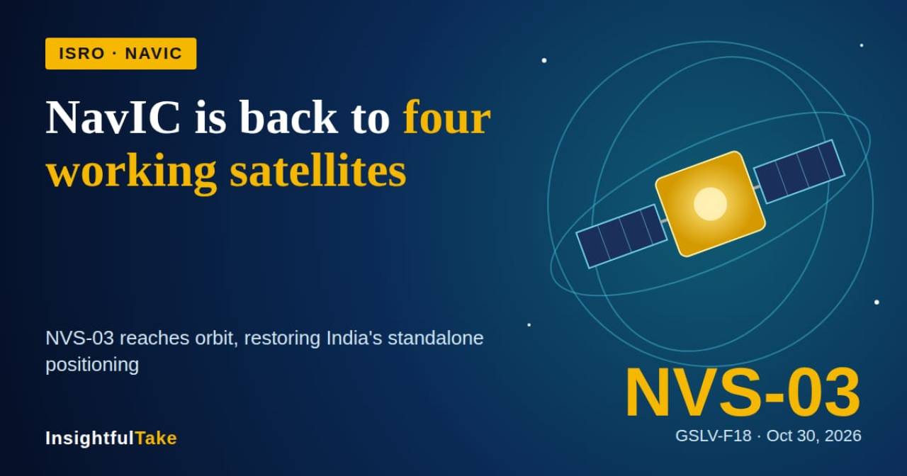
India’s latest navigation satellite restores the minimum constellation needed for independent positioning services, strengthens civilian device compatibility and reduces reliance on foreign navigation systems.
India’s indigenous navigation system, NavIC, has regained its minimum operational strength after the Indian Space Research Organisation (ISRO) successfully launched the NVS-03 navigation satellite aboard its GSLV-F18 rocket on October 30.
The rocket lifted off from the Satish Dhawan Space Centre in Sriharikota at 11:51 pm and placed the satellite into its designated orbit. The mission marked the 20th flight of the Geosynchronous Satellite Launch Vehicle (GSLV) and came just 56 days after the previous GSLV mission, the shortest interval between two flights of the launch vehicle, according to ISRO Chairman V. Narayanan.
The launch is significant because India had been without a standalone positioning service since March 2026. NavIC, or Navigation with Indian Constellation, requires at least four operational satellites to provide independent positioning and navigation services. With only three satellites functioning, the system could offer these services only in a limited capacity. NVS-03 restores the minimum constellation required for standalone positioning.
From the Kargil Conflict to an Independent Navigation System
The origins of NavIC can be traced to the 1999 Kargil conflict, when India sought access to US GPS data for the region but was denied assistance.
The episode exposed the strategic risks of depending entirely on foreign navigation systems, particularly during military conflicts and national emergencies.
India subsequently began developing its own regional navigation network, initially called the Indian Regional Navigation Satellite System (IRNSS). The first satellite, IRNSS-1A, was launched in 2013. The original constellation was designed to comprise seven satellites, with the project costing approximately ₹2,250 crore.
However, maintaining the system proved more challenging than establishing it.
Faulty Atomic Clocks Weakened the Constellation
The first major setback emerged in 2016 when the atomic clocks aboard first-generation NavIC satellites began malfunctioning.
Atomic clocks are essential to satellite navigation because positioning depends on accurately measuring the time taken by signals to travel between satellites and receivers. Even a tiny timing error can translate into a significant positioning error.
Over time, six of the eleven satellites launched since 2013 experienced failures, largely associated with atomic clock problems and orbital difficulties.
To address these weaknesses, ISRO began deploying a second generation of navigation satellites equipped with improved technology.
NVS-01, launched in May 2023, carried an indigenous rubidium atomic clock, reducing India's dependence on imported technology. However, the next mission, NVS-02, encountered difficulties in January 2025 when the satellite failed to reach its intended final orbit.
The setback affected the constellation's recovery. By March 2026, only three satellites remained operational, leaving NavIC unable to provide standalone positioning.
NVS-03 Adds Indigenous Technology and L1 Signal
NVS-03 is the third satellite in the second-generation series and is designed to improve the reliability and capabilities of NavIC.
It carries an indigenous atomic clock for precise timekeeping, strengthening India's ability to maintain its navigation infrastructure without depending on imported components.
Another important feature is its additional L1 navigation frequency. Earlier NavIC satellites primarily used the L5 and S bands. The addition of L1, a frequency widely supported by civilian navigation receivers, is expected to expand compatibility with smartphones and other consumer devices.
According to ISRO, the satellite will provide coverage across the Indian landmass and an area extending approximately 1,500 kilometres beyond the country's borders.
The expanded signal compatibility could make NavIC more accessible to everyday users while strengthening its applications in transportation, communication and other location-based services.
Railways, Fishing Vessels and Smartphones Among the Beneficiaries
Although most smartphone users may not immediately notice the impact of the launch, NavIC already supports several important public and commercial applications.
More than 10,400 Indian Railways locomotives use NavIC-based tracking systems to monitor train movements in real time. The technology helps improve operational monitoring and railway safety.
The system also supports approximately 40,000 fishing vessels, providing navigation and safety-related services. This is particularly important for fishermen operating far from the coastline, where conventional mobile networks may not be available.
In the consumer technology market, more than 60 smartphone models from major global manufacturers already support NavIC. The addition of the L1 frequency is expected to make integration easier across a wider range of devices.
These applications demonstrate that an independent navigation system is not merely a strategic asset but also an important part of India's everyday technological infrastructure.
Why NavIC Matters for National Security
NavIC provides two types of services: an open service for civilian users and a restricted service for authorised agencies, including defence and government organisations.
An India-controlled navigation network is particularly important for military operations, maritime security, disaster management and emergency response.
Dependence on foreign navigation networks can create vulnerabilities if access is restricted, signals are disrupted or services become unavailable during geopolitical tensions.
NavIC gives India greater control over critical positioning, navigation and timing services within its coverage region.
Four Satellites Are Not Enough for Long-Term Reliability
Despite the successful launch, the restoration of four operational satellites should be viewed as a recovery milestone rather than the completion of NavIC's expansion.
Four satellites represent the minimum requirement for standalone positioning, leaving little operational margin if another satellite develops a technical fault.
The remaining second-generation satellites, NVS-04 and NVS-05, will therefore be important for strengthening the constellation and ensuring continuity of services.
ISRO also appears to have incorporated lessons from the NVS-02 setback. Reports ahead of the NVS-03 launch indicated that engineers opened certain valves before liftoff, eliminating a post-launch activation step associated with the earlier mission's problems.
The successful flight suggests that the changes helped address those concerns. However, the satellite's performance during the coming weeks will be important in establishing its operational reliability.
For India, NVS-03 represents more than another successful satellite launch. It restores the minimum operational strength of a navigation system conceived after the country experienced the limitations of relying on foreign technology.
The challenge now is to move beyond the minimum requirement, strengthen the satellite constellation and ensure that NavIC remains a dependable, India-controlled alternative for civilian, commercial and strategic applications.























Leave a Comment